
Here Is A Larger Version
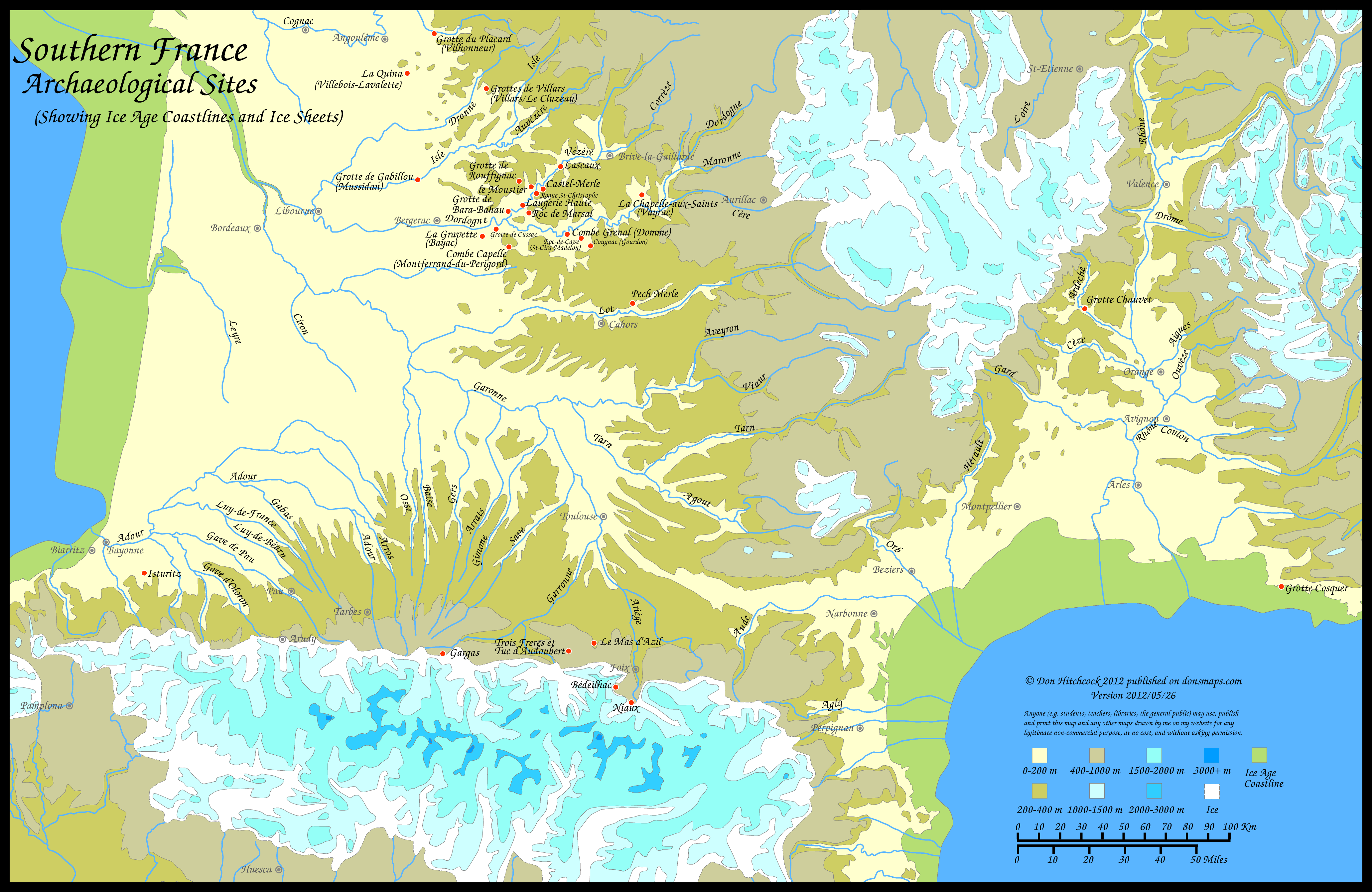
This is an Ice Age Map of Southern France created by Don Hitchcock which shown the topography, rivers, mountains, glaciers and valleys. The green areas show how far further out the ocean and seas projected from France due to there being less water available. Much was locked-up in the northern glaciers resulting in the sea level being over 400 feet lower than it is today. These coastlines are now 30 miles out under the seas. I am sure there were Cro-Magnon inhabitants there 25,000 years ago. Unfortunately I doubt we will ever find evidence of them. The red dots indicate settlements in Southern France, though all were not inhabited at the same time. CRO-MAGNON 25,000 BP takes place in this area and both the Lion and Bear Tribes live in a river valley protected from the winds out on the plains. This is their neighborhood. Note the glaciers on the surrounding mountains.
No comments:
Post a Comment